Pre-Alps

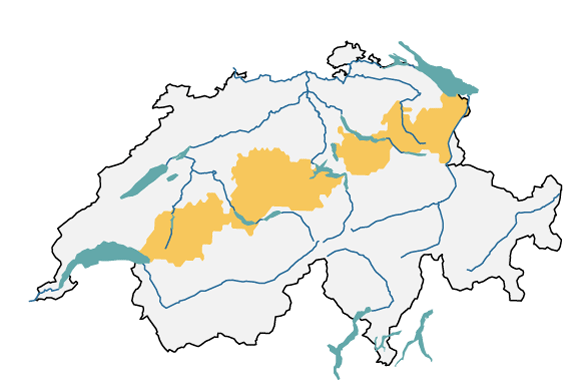
The major region of the pre-Alps comprises the hilly and mountainous areas between the Swiss plateau and the northern side of the Alps, with the highest peaks at 2,500 m asl. This page provides insights into today’s climate in the pre-Alps, as well as detailed information about possible changes in the future.

A map of Switzerland is shown with the outline of the major Swiss region of the pre-Alps. The region includes the cantons of Vaud, Freiburg, Bern, Lucerne, Obwalden, Nidwalden, Schwyz, St Gallen, Appenzell Ausserrhoden and Innerrhoden.
The biogeographical major region of the pre-Alps (in yellow), according to the Federal Office for the Environment FOEN, used to develop regional climate scenarios.

Current climate

The pre-Alps have one of the highest levels of precipitation in Switzerland. Up to 2,500 mm of precipitation per year falls along the eastern pre-Alpine. In summer, storms are a frequent occurrence, and in winter, snowfall is common even in the lower-lying areas. There is the odd summer day, even up to altitudes of 1,500 m a.s.l. North-south-aligned valleys in the pre-Alps experience regular foehn phases, primarily in spring and autumn.

Climate Change Scenarios CH2018 - Pre-Alps

If greenhouse gases continue to increase unchecked, precipitation in the foothills of the Alps is likely to increase in winter and decrease in summer. Due to the higher temperatures, however, winter precipitation is increasingly falling as rain instead of snow. The number of days with fresh snow is declining significantly, especially at medium and high altitudes. The rise in temperature results in an increasing number of summer days and tropical nights at low and medium altitudes.

Last modification 07.09.2023

Top of page

Contact

Federal office of meteorology and climatology MeteoSwiss
Operation Center 1
P.O. Box
CH-8058 Zurich-Airport

Contact

Print contact

https://www.nccs.admin.ch/content/nccs/en/home/regionen/grossregionen/voralpen.html