
The interactive application sonnendach.ch shows users anywhere in Switzerland how well suited their building is for producing energy. sonnendach.ch was set up as part of the Swiss government’s Energy Strategy 2050, as a joint project between the Federal Office of Energy, the Federal Office of Meteorology and Climatology (MeteoSwiss) and the Federal Office of Topography (swisstopo). For the purposes of the project, the company Meteotest collated all of the baseline data from the three Federal Offices and worked out the solar potential from these to provide a free climate-related service.
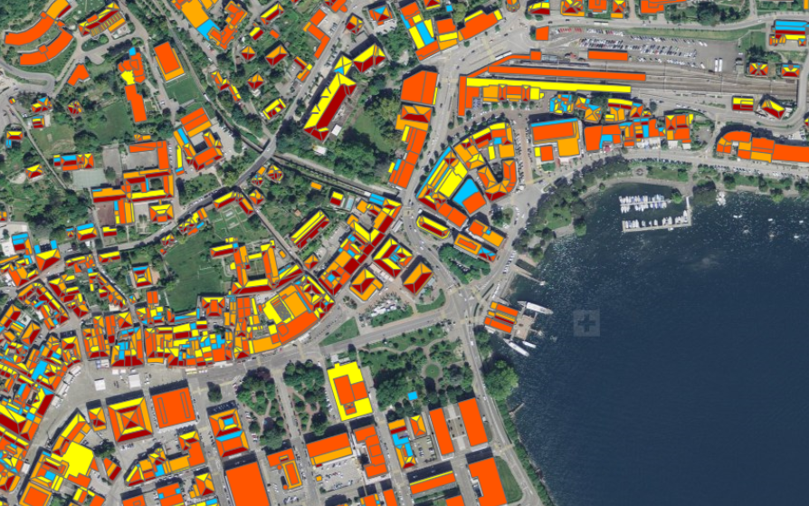
After existing solar potential analyses were tested for their usefulness, the project developed a new user friendly approach from scratch. sonnendach.ch enables interested members of the public to estimate their solar potential with one or two mouse clicks. Even those living in smaller communities will thus be able to get an estimate of the solar potential of their roof or facade.
The MeteoSwiss contribution
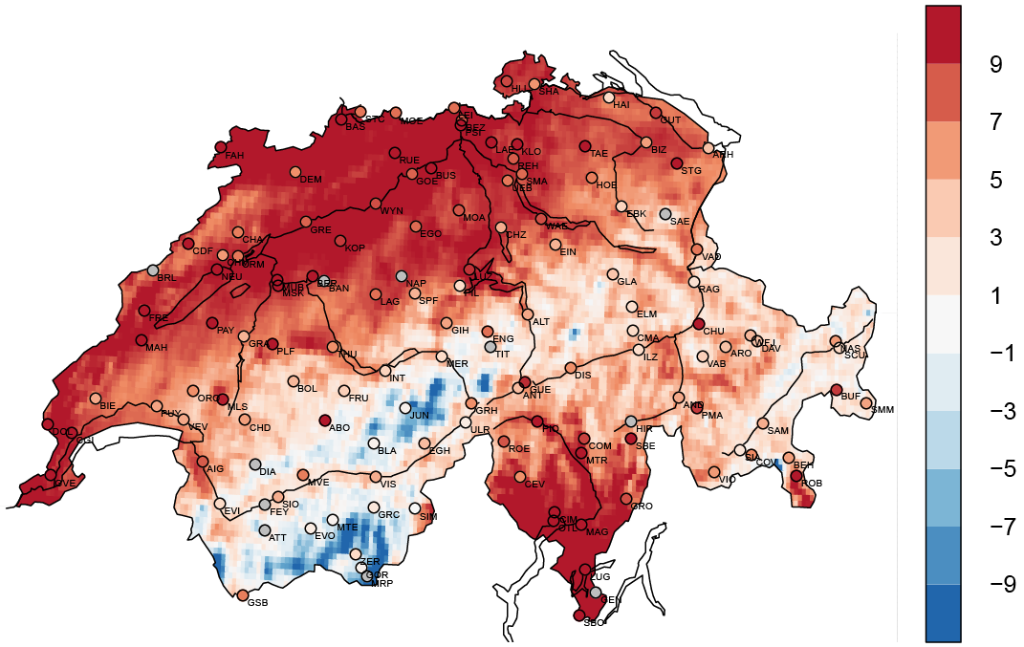
MeteoSwiss is participating in the project through its climate services in the context of the National Centre for Climate Services (NCCS). Our spatial data on incoming solar radiation differ according to the position of the sun, cloud cover and region. To estimate the local solar radiation, satellite measurements are used from the “METEOSAT Second Generation” geostationary earth-observation satellite. Satellite data are ideal for supplementing the ground-based measurements, as they supply information that fills the gaps in the ground-based data have gaps (see figure 2). The calculation method was developed and tested over several years in a collaborative research project in the context of the EUMETSAT Satellite Application Facility on Climate Monitoring (CM SAF) with a focus on the complex topography of the Alps.

The Swiss government’s Energy Strategy 2050 stipulates that there should be a greater use of renewable forms of energy. The use of such energy is heavily dependent on weather and climate. MeteoSwiss therefore plays an important part in the efficient implementation of the energy strategy, thanks to its meteorological and climatological data and Expertise.
Last modification 18.07.2022


Contact
Office of the National Centre for Climate Services NCCS
Federal Office of meteorology and climatology MeteoSwiss
Operation Center 1
P.O. Box
CH-8058 Zurich-Airport
Director
Angela Michiko Hama